Map of Central Israel showing Bethel and Ai
Click on Add map to cart button below shopping cart.
Purchased Maps do not have watermarks, are high resolution (150dpi) & have crisp, clear labels/town names.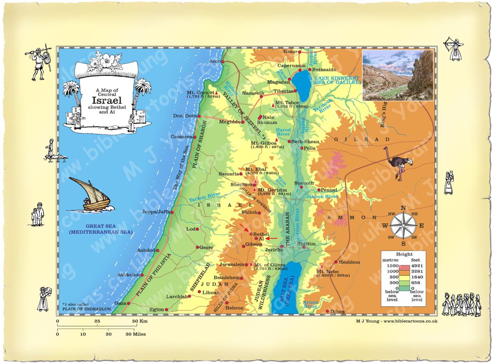
Bible Book: Genesis
Bible Book Code: 0101200801a
Bible Reference & Map Description
This is my map of Central Israel, showing the position of the ancient settlements of Bethel and Ai, which were situated south of Shechem, in the hills of Israel. The city is mentioned nearly 60 times, in 13 different books of the Bible. The first reference to Bethel and Ai being in Genesis chapter 12, when Abram & Sarai camp between the settlements, and Abram builds his second altar there.
Date
Abram journeyed from Haran to Shechem and on to bethel and Ai about 1855 B.C.
Notice the figures on the border of the map.
If you look carefully at the map border you will see I have included some little black and white figures.
Link(s) to related Bible Cartoons
Click orange bar below to see the Bible Cartoon relating to Bethel and Ai, on the BC Gallery page, with download & purchase options:
Bible Cartoon: Genesis 12 – Call of Abram – Scene 05 – Bethel and Ai camp altar
Bible References
Genesis 12:8 (NLT)
After that, Abram travelled south and set up camp in the hill country, with Bethel to the west and Ai to the east. There he built another altar and dedicated it to the Lord, and he worshipped the Lord.