Blank Bible Cartoons Map: Israel - Aerial perspective (without town dots)
Click on Add map to cart button below shopping cart.
Purchased Maps do not have watermarks, are high resolution (150dpi) & have crisp, clear labels/town names.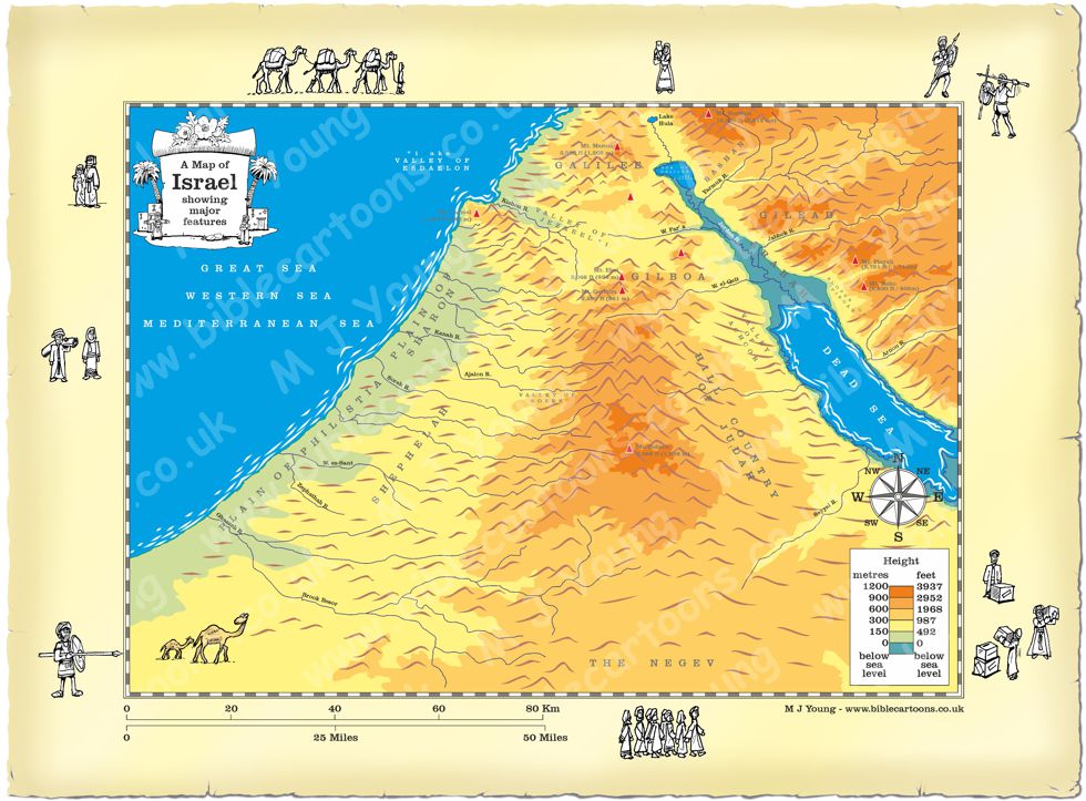
Bible Book:
Bible Book Code: 0000000602a
Bible Reference & Map Description
This is my map of Israel based on an aerial view of the country, about 53 km above the surface, looking from the South towards the North. I have applied perspective to the map, so the land appears to shrink away from the viewer & gets smaller towards the North. I decided to use similar colours to represent height above sea level (& below it, in the case of the Jordan/Arabah valley!) that I have used in other maps. I have also added brown terrain lines to try to indicate mountains & hills, upland areas, slopes, etc.
This version of the Israel map does not include some major towns/cities, although it still shows some rivers, mountains & region/terrain names. The map is kept deliberately free of trade routes & other markers, so that customers can buy this map & use it in their own presentations, where arrows, points of interest, notes, routes, etc can be added.
Notice the figures on the border of the map.
If you look carefully at the map border you will see I have included some little black and white figures. I will add different figures to the borders of each map, adding characters that relate to the map subject.