Shechem city

Genesis 12 – Call of Abram – Scene 02 – Shechem
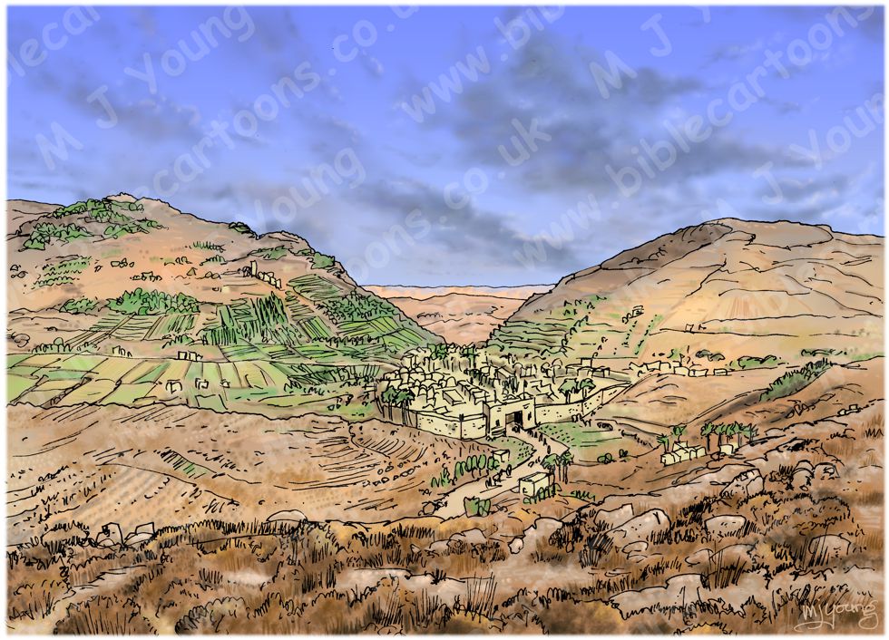
I drew this scene to illustrate the town of Shechem, at the time of Abram/Abraham.
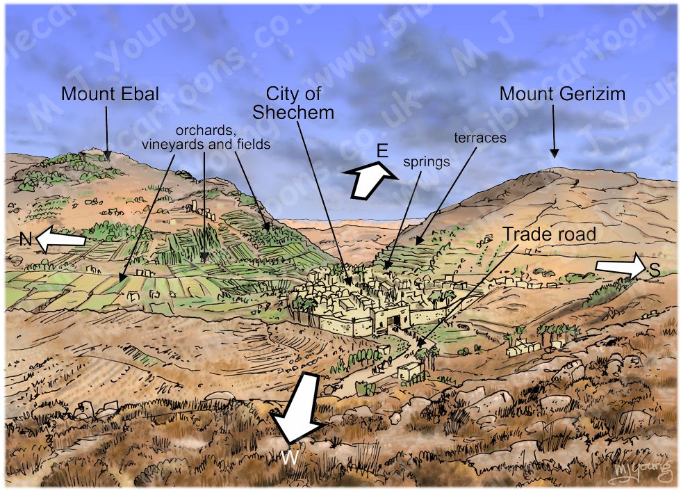
Below is a diagram showing the compass orientation and main features of the landscape surrounding Shechem.

Mount Gerizim, Mount Ebal and Shechem
Click on the colour bar below to view/buy this Map diagram:
Mount Gerizim, Mount Ebal and Shechem
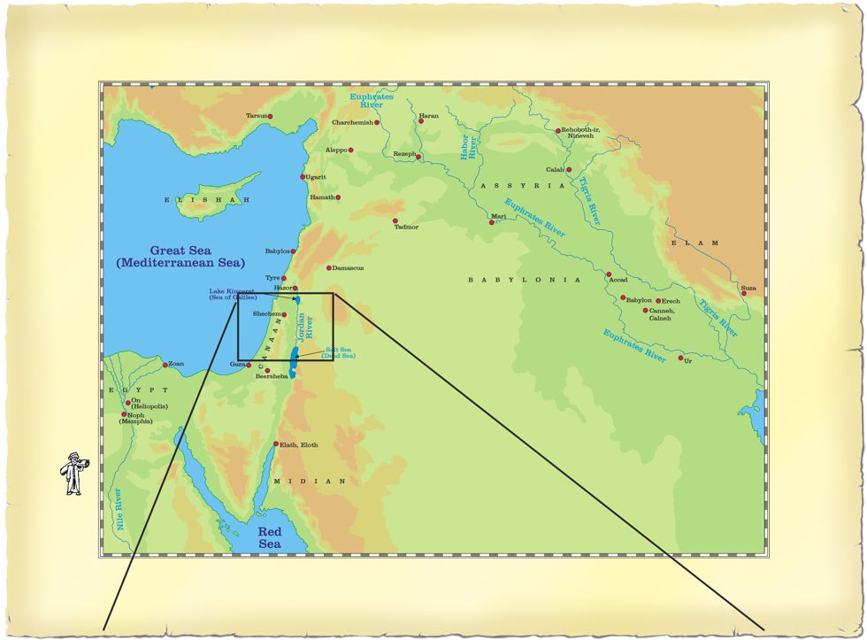
This place is first mentioned in Genesis chapter 12, in relation to Abram/Abraham’s journey from Haran (which is in modern day Turkey). It was near the town/city of Shechem that Abram/Abraham set up his camp, by the oak of Moreh. Shechem is noted as a city, although in antiquity it probably had only a few thousand inhabitants. Since the population of settlements was measured in tens or hundreds, that would make Shechem a “city” by these early standards.
According to Genesis 12:6 “At that time, the area was inhabited by Canaanites.” It would be reasonable to assume that they also inhabited the city of Shechem. Archeological evidence of settlement dates from the Middle Bronze II period (c. 1900–c.1750 B.C.), generally associated with the time of the biblical patriarchs.
The city’s location is beyond doubt; it lay nestled in the valley pass which runs between Mount Ebal and Mount Gerizim. These hills have provided protection to the city on the North and South respectively for centuries. A very important trade route road runs between these hills, and through Shechem, bringing merchants and their goods to the city for hundreds of years. This road route (one of only a few such routes passing through the hills of the region) formed the easiest and quickest means of communication between the East of the Jordan and Jaffa/Joppa, an important sea port on the coast of the Mediterranean sea.
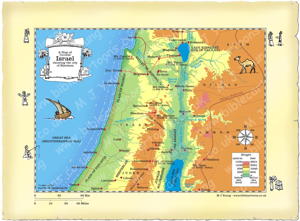
The city of Shechem lies about 30 miles (48 kilometres) north of Jerusalem and about 27 miles (43.5 kilometres) east of the coast of the Mediterranean sea. Mount Ebal is 3,083 feet (940 metres) from sea level, whereas Mount Gerizim is 2,889 feet (881 metres) at its summit. The feet of these mountains, where they rise from the city of Sheckem, are not more than 500 yards (457 metres) apart.
The city’s situation has always been one of great beauty; it lies close to the foot of Mount Gerizim, whose terraced slopes (see my illustration) rise steeply on the South. Many springs rise at the base of Mount Gerizim, supplying an abundance of water to the area, resulting in good agricultural lands of fertile grain fields and orchards. Across the valley the great bulk of Mount Ebal rises to the North. The fruitful and well-wooded valley in which Shechem resides, runs westward among the hills.
In ancient times the slopes of Ebal were covered with vineyards, but these formed a source of temptation to the Samaritans. The authorities of the time therefore removed the vineyards, and their place taken by many prickly pears instead. I have shown these vineyards in my illustration, as at the time of Abram/Abraham they would still have been on the slopes of that hill.
Some scholars would place the location of the ancient Oak of Moreh on the plain of Makhneh, eastward of the Shechem valley in a recess at the base of Mount Gerizim. Here is a sanctuary known as Rijal el-`Amud, which literally translates to “men of the column” or “pillar”. Other scholars would locate the Oak of Moreh a bit farther East, in a little village called BalaTa, a name which may be connected with balluT or “oak”. Still farther to the East and nearer to the base of Mount Ebal is the traditional location of the tomb of Joseph, beside a luxuriant orchard.
To the South of the valley is the traditional location of Jacob’s well. To the Southwest of the city is the spot where Jacob is said to have mourned over the blood-stained coat of his son Joseph.


Map of Central Israel showing Shechem
Link to related Map
Click colour bar below to see the Map showing city of Haran, with purchase option:
View/Buy Map
Link(s) to related Bible Cartoons
Click orange bar below to see the Bible Cartoon of Shechem, on the BC Gallery page, with download & purchase options:
Bible Cartoon: Genesis 12 – Call of Abram – Scene 02 – Shechem
Return to BC Encylopaedia Index page
